Siloplot / Historical sample
Parcel analysis
2177 NW 28th St · October 6, 2026
Review the report findings, their stated sources, and the questions still open for verification.
Miami / Pre-acquisition study
Before acquiring
2177 NW 28th St…
Follow one Miami parcel from its boundary to the rules and conditions that shape what might come next.
What do we know about this site?
Follow one Miami parcel from its boundary to the rules and conditions that shape what might come next.
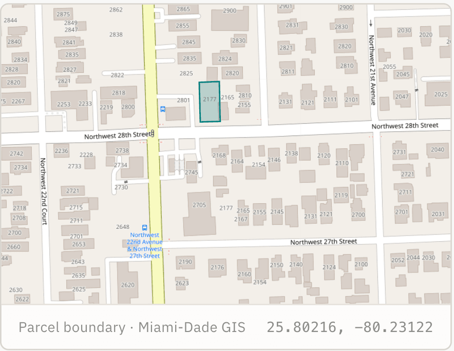
2177 NW 28th St
Miami · Folio 01-3127-031-0060
- Lot area
- 7,203 sf
- Zone
- T5-O
Urban Center Transect Open
What can the zoning allow?
28,810 sf
80% lot coverage over 5 stories. This is the starting envelope in the supplied analysis.
32,412 sf
+3,601 sf
The Flexible Lot Coverage Program allows coverage up to 90%. The report marks this gain conditional: confirm eligibility before treating it as buildable.
Up to +230,483 sf
FLR 36
The report gives an FLR-36 cap of 259,294 sf. This is a statutory cap, not realizable area: setbacks, parking, flood elevation, and the design program may reduce it.
The basis of a finding
Every figure should travel with its source.
This example separates the cited authority, parcel inputs, and report determination so each can be reviewed.
- Authority cited in the report
Miami 21, Article 5
Illustration (T5-O)
Open T5 reference - Parcel inputs
7,203 sf · T5-O
Live Miami-Dade GIS is the source named in the October 6, 2026 report.
- Calculation basis
80% coverage × 5 stories
Applied to the reported lot area. Exact source excerpt and version are not included in this sample.
- Report determination
28,810 sf
Marked confirmed in the supplied report. Reproduced as issued, without recalculation.
What this sample establishes
The report supplies the figures and citations shown here. Its Flexible Lot Coverage finding still cites Zoneomics/T5-O; primary-source reconciliation remains outstanding. General reference links are labeled accordingly. This historical example does not establish current parcel eligibility.
What could reduce the envelope?
Zoning, site conditions, and incentives share one parcel. Their requirements still need to be read together.
What still needs verification?
Four material constraints remain marked “Confirm” in the October 6, 2026 report.
- T4 transitional setback
- Locate the abutting edge and verify the applicable setback by survey.
- FEMA flood zone AE
- Verify the base flood elevation and its effect on the design.
- Special Area Plan / NCD
- No boundary layer loaded; the report cannot rule these out automatically.
- Waterfront standards
- Conditional on water abutment; not an established waterfront condition for this parcel.
Source: Siloplot sample report, generated October 6, 2026. Pre-acquisition screening, not legal, engineering, or financial advice. Conditional levers require verification with qualified advisors. Figures are reproduced exactly from the report.